Contact Information
Request your free guide or ask us a question.
Download Our Visitors Guide
Request Information about Franklin, NC
Follow us on Social Media
Contact the Chamber
VISITORS GUIDE
Download our helpful visitors guide.
NEED A MAP?
Helpful maps for your adventure.
LATEST WEATHER
Check the local weather forecasts
ROAD CONDITIONS
Information on the latest road conditions.
Driving directions to Franklin, NC
From Asheville
Take I-40 West to Exit 27 (23 South/74 West).
Stay on 23/74 to Exit 81 (U.S. 441/23 South).
Approximately 18 miles to Franklin from this exit.
Approximately 65 miles.
From Atlanta
Follow I-85 North to I-985.
Left on I-985 which becomes 23/365 North.
23/365 becomes 23/441 North. Follow straight into Franklin.
Approximately 125 miles.
From Greenville, SC
Take I-85 South to Exit 19 (Clemson).
Follow 76 West to Clayton, Georgia.
Take U.S. 441 North straight to Franklin.
Approximately 110 miles.
From Knoxville, TN
Interstate: I-40 East to Exit 20 (Hwy 276 South).
Stay south on 276 until reaching 23/74 South.
Follow to Exit 81 (U.S. 441/23 South).
Approximately 18 miles to Franklin from this exit.
Approximately 130 miles.
Scenic
Take U.S. 441 South from Knoxville to Sevierville (approximately 25 miles).
Remain on 441 South to Pigeon Forge/Gatlinburg.
Take a by-pass around Gatlinburg.
Remain on 441 South through the Great Smoky Mountains National Park to Cherokee.
Stay on 441 South to Franklin (35 miles from Cherokee).
Approximately 110 miles
Weather & Climate of Franklin, NC in Macon County
Geography
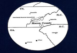
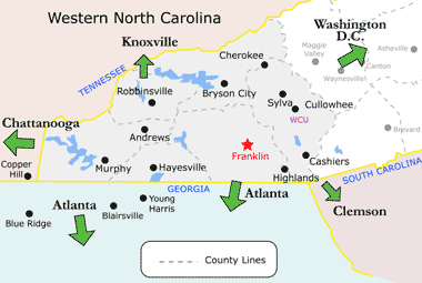
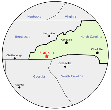
Macon County is located in southwestern North Carolina, about 65 miles west of Asheville, NC, and 130 miles north of Atlanta, GA. The county lies within the Blue Ridge Physiographic Providence and contains several mountain ranges with peaks over 5,000 feet in elevation.
The county land area is 516 sq. miles and the population is 33,756. Franklin, the county seat, lies near the center of the county at an elevation of 2,110 feet with a population of 3,490. Highlands is the other major town in the county with a population of 1,100 year-round residents and is the highest incorporated town(4,118 feet) east of the Mississippi River. Major highways run north-south in the Little Tennessee River Basin and east-west across mountain ranges.

Climate
The climate of the region is classified as marine, humid, and temperate because of high moisture and mild temperatures. Four distinct seasons provide a diverse climate. Although the county is in one of the highest rainfall zones in the eastern U.S., there can be large spatial variability in precipitation amounts during storm events.
Average Temperature
(degrees Fahrenheit) Coweeta Hydrologic Laboratory, 1934-2007

